A virtual stroll through the city
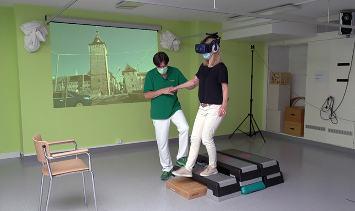
Virtual Reality (VR) applications offer the possibility to experience the complexity of cities both above and below ground. These virtual landscapes can also be used for therapy of gait-impaired pa-tients.
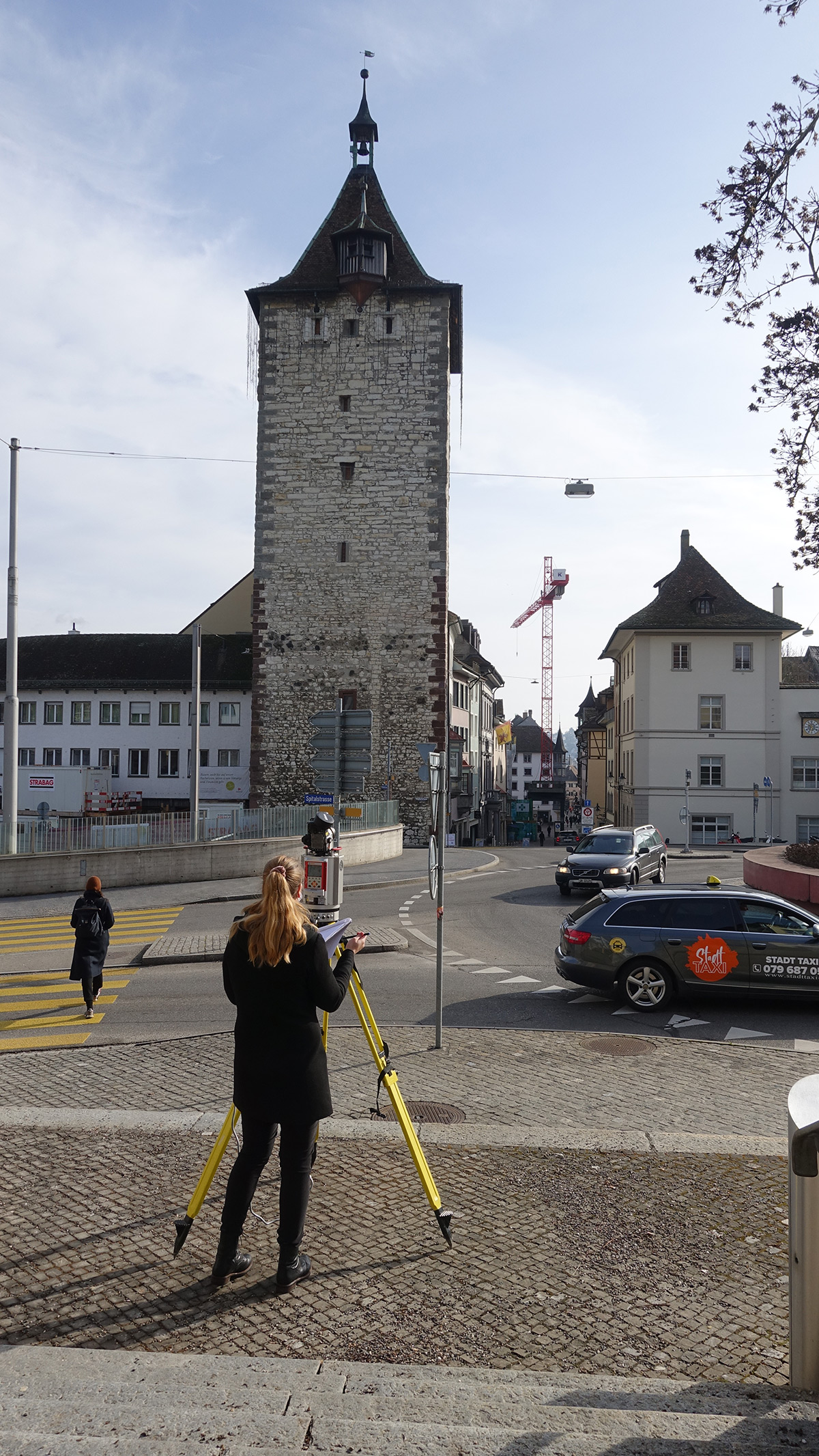
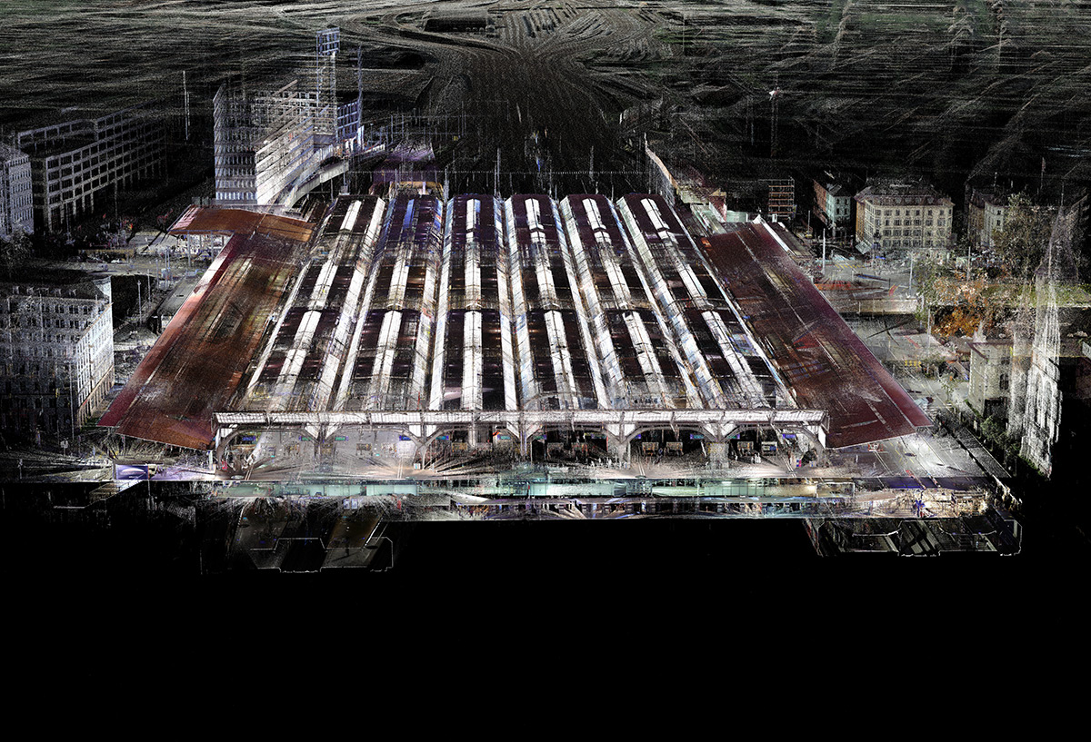
Although the city is becoming an everyday living space for more and more people, its complexity sometimes seems overwhelming. Moving safely in urban space and orienting oneself spatially then becomes a problem. In order to be able to imagine the city in a more holistic way, both above and below ground, we record urban landscapes with 3D laser scanners and use the scans to create pre-cise and realistic digital 3D point cloud models.
In collaboration with the city of Zurich, we are creating an interactive and detailed model of the city above and below ground at the Institute for Landscape and Urban Studies (LUS). In addition to the goal of a holistic mapping, we focus on how to represent and communicate our living space by means of geodata and how these in turn change our perception of the urban underground. Equipped with VR goggles, viewers can choose their own viewpoint in an interactive environment and explore different areas of the city.
These virtual landscapes can also provide patients a training environment in which they can safely practice mastering certain everyday situations. For example, in collaboration with physiotherapists of the Schaffhausen Hospitals, at the chair Planning of Landscape and Urban Systems (PLUS) we are test-ing approaches to use very realistic audio-visual 3D simulations of urban situations for the therapy of gait-impaired patients. Try it yourself!
These projects are supported by the City of Zurich, Spitäler Schaffhausen, RIEGL Laser Measurement Systems GmbH, Leica Geosystems AG, SCANVISION GmbH and SBB.